

01 - La Thuile - Haute Tarentaise/1 carta dei sentieri 1:25.000 e guida


Map of the trails of La Thuile and Haute Tarentaise with guide to the most beautiful excursions attached.

Spesa minima per la spedizione gratuita: €50.00
NOTA: Valido solo per spedizioni in Italia
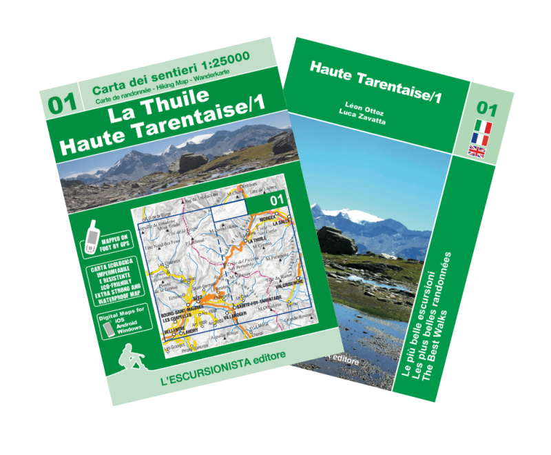
Hiking map n°01 of the Italy/France cross-border series. It covers the area of La Thuile (Valle d'Aosta) and Bourg-Saint-Maurice, Montvalezan, Sainte Foy-Tarentaise, Séez, Villaroger with the areas of La Rosière and Les Arcs (Haute Tarentaise), with walking and walking routes mountain bikes marked. Printed front and back on ecological, waterproof, tear-proof paper and all the paths shown (signposted and unsigned) have been recorded with GPS satellite equipment. The cartographic design, rocks, gravels and glaciers also covers the territory beyond the border with homogeneous graphics. Packaged in a plastic bag with a guide to the "most beautiful excursions", 8 itineraries selected among the most beautiful in the area, with historical-cultural insights and illustrations, a new series of practical and handy booklets that will accompany the 1:25,000 scale maps of the border territory between Italy and France.
| Product code | CON01 |
|---|---|
| Author | Zavatta L. |
| Publisher | L'ESCURSIONISTA EDITORE |
| Series | OLTRE CONFINE/PAR DE LA' LES CONFINS |
| Scale | 1:25.000 |
| Languages Guidebook | Italian, English, French |
| Languages Maps | Italian, English, French, German |
| Year | 2022 |
| States | France, Italy |
| Regions Italy | Valle d'Aosta |
Weight
Spedizione con corriere in max 48 ore.
Qualora l'imballo evidenzi danni / manomissioni NON accettare la merce