


02 - Val d'Isère - Tignes - Vallées du Grand Paradis carta dei sentieri 1:25.000 ANTISTRAPPO
€12.00
In stock
Product code
CON02
Autore:
Zavatta L.
Collana:
OLTRE CONFINE/PAR DE LA' LES CONFINS
Editore:
L'ESCURSIONISTA EDITORE


Map of the Gran Paradiso, Val d'Isère, Tignes and Arc 2000 trails with illustrated guide.

Spesa minima per la spedizione gratuita: €50.00
NOTA: Valido solo per spedizioni in Italia
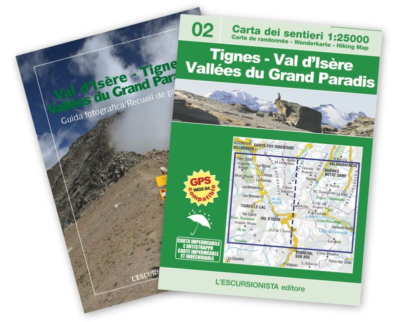
Hiking map n°02 of the Italy/France cross-border series. It covers the area of the upper Valgrisenche, Val di Rhêmes and Valsavarenche (Valle d'Aosta), Valle dell'Orco (Piedmont), the municipalities of Tignes and Val d'Isère (Haute Tarentaise), reaching up to the gates of the town of Bonneval-sur-Arc (Haute Maurienne) and Les Lanches (in the Nancroix-Pesey valley. With signposted walking and mountain bike routes, as well as all the minor paths. Printed on waterproof and tear-proof paper, with satellite tracking of the paths via GPS. Packaged in plastic bag with 32-page photo guide.
| Product code | CON02 |
|---|---|
| Author | Zavatta L. |
| Publisher | L'ESCURSIONISTA EDITORE |
| Series | OLTRE CONFINE/PAR DE LA' LES CONFINS |
| Scale | 1:25.000 |
| Languages Guidebook | Italian, French |
| Languages Maps | Italian, English, French, German |
| Year | 2017 |
| States | France, Italy |
| Regions Italy | Valle d'Aosta |
Write Your Own Review
Weight
0.15 (Kg)
Spedizione con corriere in max 48 ore.
Qualora l'imballo evidenzi danni / manomissioni NON accettare la merce