


03 - Chamonix-Mont-Blanc - Trient - Courmayeur carta dei sentieri 1:25.000
€13.00
In stock
Product code
CON03
Autore:
Zavatta L.
Collana:
OLTRE CONFINE/PAR DE LA' LES CONFINS
Editore:
L'ESCURSIONISTA EDITORE


Chamonix-Mont-Blanc - Trient and Courmayeur trail map with hiking guide.

Spesa minima per la spedizione gratuita: €50.00
NOTA: Valido solo per spedizioni in Italia
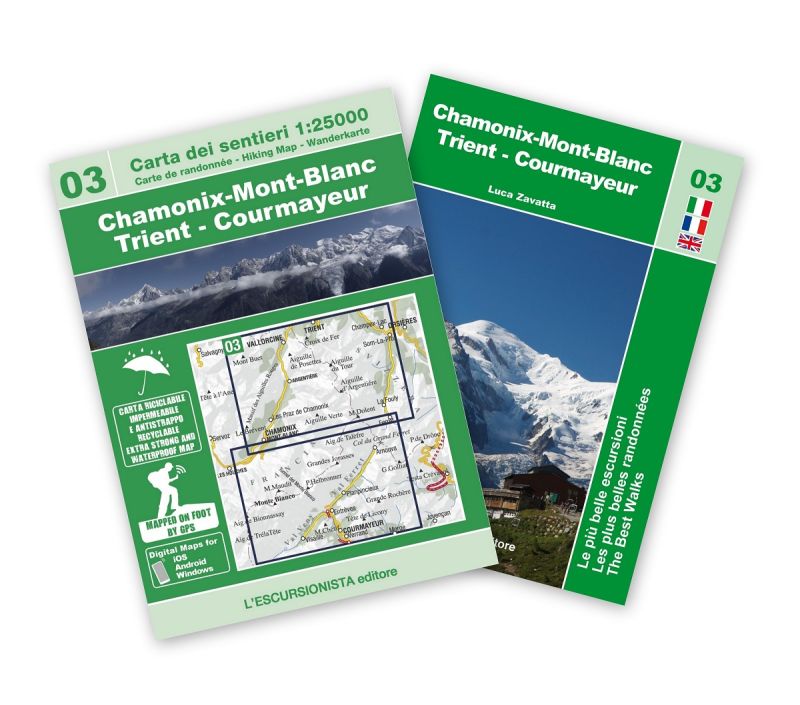
Hiking map n°03 of the Italy/France cross-border series. It covers the area of Chamonix-Mont-Blanc, Aiguilles Rouges, Vallorcine and Mont Buet (Vallée de l'Arve), Trient, Champex and Val Ferret Switzerland (Orsiéres), Val Ferret and Courmayeur (Valdigne). With long-distance routes (Tour du Mont Blanc Nord, Pays du Mont Blanc, Tour de la Vallée du Trient, Trail Verbier - Gran Saint-Bernard and Alta Via 1 of the Aosta Valley, as well as all the minor trails. Printed on the front and back, with satellite tracking of the paths via GPS. Packaged in a plastic bag with a guide to the 9 "most beautiful excursions".
| Product code | CON03 |
|---|---|
| Author | Zavatta L. |
| Publisher | L'ESCURSIONISTA EDITORE |
| Series | OLTRE CONFINE/PAR DE LA' LES CONFINS |
| Scale | 1:25.000 |
| Languages Guidebook | Italian, English, French |
| Languages Maps | Italian, English, French, German |
| Year | 2020 |
| States | France, Italy |
| Regions Italy | Valle d'Aosta |
Write Your Own Review
Weight
0.15 (Kg)
Spedizione con corriere in max 48 ore.
Qualora l'imballo evidenzi danni / manomissioni NON accettare la merce